Circular route that runs between the plain of the Vallès and the mountain range of Collserola, very close to Sant Cugat del Vallès. About an hour and a half, it has different links that allow lengthen it or shorten it according to our needs.
ROUTE
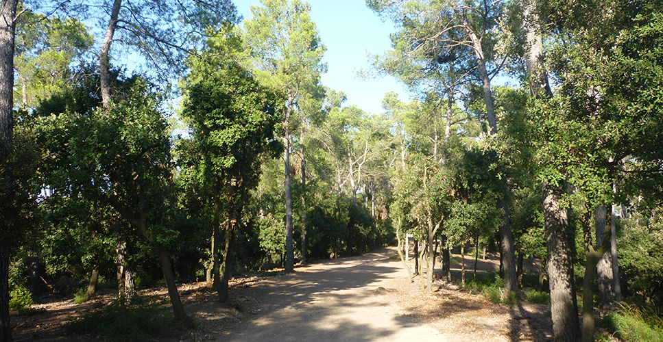
We come out of the riding centre by the access road to the right. About 200 m further, when the houses have finished, we take a path that descends on the left, between white pine with clear undergrowth, rich in Mediterranean buckthorn. To the left you will notice the effects of the gusts of wind with snow in the winter of 2010, when many branches were broken and some specimens of pine were knocked down and we can see the land emptiest than the rest.
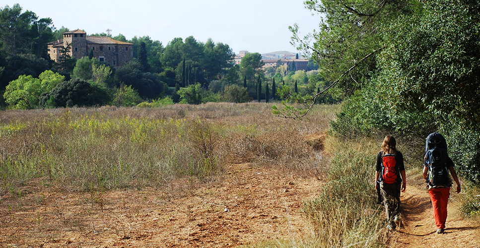
When reaching the field, we follow it to the right. From here we have a good overview of the Prelitoral mountain chain, standing up the summit of La Mola of Sant Llorenç del Munt. At the end of the field we go through a path in the middle of the hurdle, with American cane, invasive species of our torrents. We cross the ravine of Sant Medir, carrying water from the reservoir of Can Borrell.
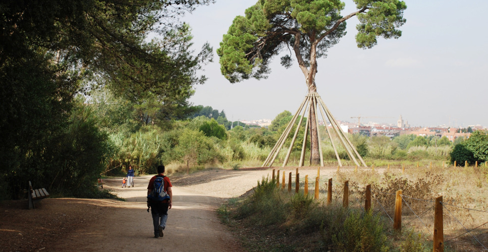
We come out to one of the main roads of the park, the GR-6, just below the Pi d’en Xandri, ranked as the pine tree with the largest crown of Collserola. It is bordered by a small fence with wedges since, despite of enjoying of the sympathy of the population, it has suffered some acts of vandalism.
We continue about 300 m on the right and we head for to the left margin to go by the side of another grain field, fields of torre Negra, that now are on our back, until the path turns to the right, now following the top of the fields of torre Cendrera. At the end of this, we go straight and up through a clayey path that passes beneath pine trees and holm oaks.
This path ends in a flatter forest track which we take to the right, following the indication of torre Cendrera: small forest masia. On the right we find a detour that goes down straight enough again toward the GR. All this stretch we pass under the dispersed holm oaks and white pine, with poor undergrowth. Periodically, there are drives of wild boars, to avoid the overpopulation in the park.
We go through holm oaks and oaks, and richer undergrowth with mastic, oak and steppe in the sunniest spot parts. The road goes down slightly until we reach another track: if we went to the left we would go to Flor de Maig and Can Coll, another possible route.
We will turn to the right, towards Can Borrell. We first see the fields, with the Tibidabo in the background. Here the land is richer in sand and in the margins we can see some vein of limestone rock. We observe a slight change of vegetation until we are surrounded by white pine, some dispersed pine trees and a dense undergrowth of heather. In a curve to the left we can see the masia well and the remains of forest exploitation in the area.
When we reach Can Borrell, old masia which is currently being remodelled, we can border it to the left, going to Can Jané, Sant Medir and Sant Adjutori (unique Romanesque chapel of a circular plan of Collserola), other routes of about 3 hours. We could also head for Can Catar and the Forat del Vent (behind the cemetery of Horta) or visit the Font Groga: a longer route, of about 5 hours.
If we return to our route, just past Can Borrell we take the track that goes off to the right: we have the forest to our left and a small fallow land and the parking on the right. This track goes down slightly to connect with the GR-6. The vegetation here is a forest made up of a mixture of pine trees and holm oaks. Just before arriving to the Pi d’en Xandri, we leave the main road taking a path to the left. Passing among 4 canes we cross the ravine of Sant Medir and we surround the torre Negra. We will take the path of the beginning again.
ACCUMULATE GRADE
DON’T MISS…

Parc de Collserola: it is a green surface of more than 8000 situated between the rivers Llobregat and Besòs, the depression of the Vallès and the plain of Barcelona. A green island in the middle of one of the more dense urban areas on the Mediterranean coast that includes part of the municipal area of nine cities.
The Collserola massif, of 17 km in length and 6 km in width, looks out to the sea from a very steep slope and in the Vallès from numerous valleys and wooded areas. Its profile is made up of numerous hills and the Tibidabo is the highest one (512 m.). The human footprint is manifested in the mountain range, both by the modification of the landscape and the amount of archaeological remains and constructions that are found and which constitute a very valuable heritage.
Can Borrell: masia from the 17th century that due to its location in the old way of Sant Cugat to Barcelona and transit point towards Sant Medir, became a forced stop, first by the farmers of the area that brought their products to the capital and later by hikers and pilgrims of Sant Medir. On the day of this celebration the house opened its doors to the front and back and became a part of the way. On the way back, there was a dance and danced the last sardana of l’Aplec. Until recently, it was still celebrated the last dance of the party.
Pi d’en Xandri: pine tree of considerable height, located among the cultivated fields close to Sant Cugat. It is 23 meters height and has a trunk of 3.20 meters of perimeter. On 1995 it was declared tree of local and regional interest. On 1997 it suffered an attack of vandalism that caused it very serious damage. It was necessary to insert living wood in the wounds so that the sap could return to move and it was braced.
The torre Negra: Romanesque construction from the 11th century, built to protect the path of Sant Cugat to Barcelona. Of solid appearance and dark colour, hence its name, it is in a good state of conservation. It has 3 floors of height and a square tower attached to a corner of the building.
Forat del Vent: mountain pass of the mountain range of Collserola (349 meters) and ancient viewpoint of extraordinary visibility.
Les Fonts de Collserola: in the mountain range of Collserola water is abundant and we know it because of the large number of springs that exist.
SUGGESTIONS
The different viewpoints of Collserola, Can Cató, the springs of Sant Vicenç and Gordi, the swamp of Can Borrell, the Forn Ibèric we find near the chapel of Sant Adjutori, the masia of Can Coll, the chapel of Santa Maria of the Feixes and the chapel of Sant Iscle are points of interest near this route.
Place
Sant Cugat del Vallès
Place of start
Passatge Calado, 12 (detour to the left of the road to the Ravassada)
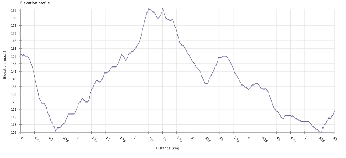
Duration
1 h 30 min
Distance
5,9 km
Technical difficulty
Low (it can be adapted to medium level)
Contact
COMPANY: Horse riding Severino
PERSON OF CONTACT: Leyre
ADDRESS: Passatge Calado, 12 (detour to the left of the road to the Ravassada)
ZIP CODE: 08173
MUNICIPALITY: Sant Cugat del Vallès
Telephone: 93 674 11 40 / 670 345 104 / 93 692 06 77
WEB: www.hipicaseverino.com
A/E: info@hipicaseverino.es
TOUR PRICE: to be consulted
ATTENDEES: They have 12 horses of school.
Score
[Total: 0 Average: 0/5]
Gallery
Share it


Send it to a friend


Download GPX route
![]()
Also you may be interested in…
The masies of Sant Cugat and the Torre Negra
Discover the masies of Sant Cugat and its historic Torre Negra (Black Tower).
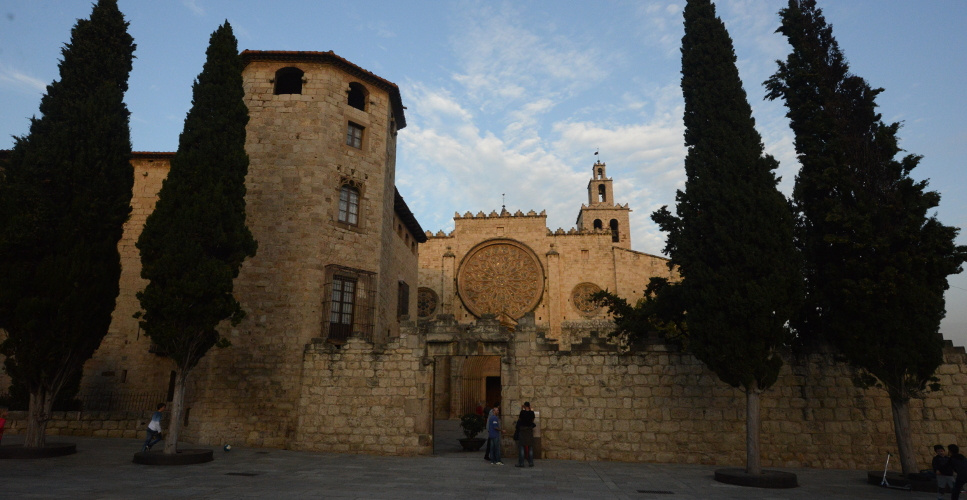
Sant Cugat’s Monastery Museum
Visit one of the most important and preserved monastic ensembles of Catalonia.
The Xandri’s Pine
You will discover Xandri’s Pine in this route, one of the oldest pines in Catalonia.
No Comments