
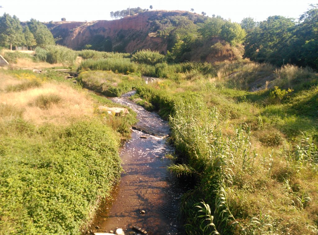
The Ripoll River is an exceptional testimony to the history of Sabadell, with an important significance for the city on an economic, social and cultural level, with a landscape of great beauty that brings together several elements of heritage interest that we encourage you to discover.

Historically, the river area has been dedicated to agricultural and industrial production. Already in the Middle Ages, flour mills settled around the river which later became drapery and paper mills. Later, more factories were built there.
In recent years, and after a period of degradation, this natural space has been restored and has become a pleasant place to walk or bike. Now you will find breeding birds such as the duck, the grebe, or the water hen. You will also spot blue herons, herons or cormorants in winter and fish such as barbels or carp.
We propose you to discover this beautiful natural environment from a route extracted from this document edited by the town hall of Sabadell.
This is a linear route * and can be done one foot or by bike.
*This linear route allows you to discover the entire River Park in the municipality of Sabadell or make connections with the river areas of Castellar del Vallès and Barberà del Vallès.
Route: 11 kilometres
Approximate time: 4 hours on foot
LET’S GO!
We will leave from the picnic area near Sant Julià d ‘Altura, this is a medieval church that was extensively renovated over time, especially during the 17th century. Initially this parish belonged to the district of Sant Pere de Terrassa until 1904, when it became part of the municipality of Sabadell.
From this picnic area we will need to take the path that leads to Ribatallada. All the way down we will find on our left the Font dels Capellans (spring of the Chaplains) and la font del suro (Cork’s spring), we will continue descending to see the ruins of the old castle of Ribatallada, where later we will have to turn right and go into the stream of Ribatallada (a tributary on the right bank of the Ripoll river) until you reach the path of the river (at the border with Castellar del Vallès). On the right, we will see the old lime kiln of Ribatallada, a structure dug in an upper margin at the foot of the road that has been rehabilitated.
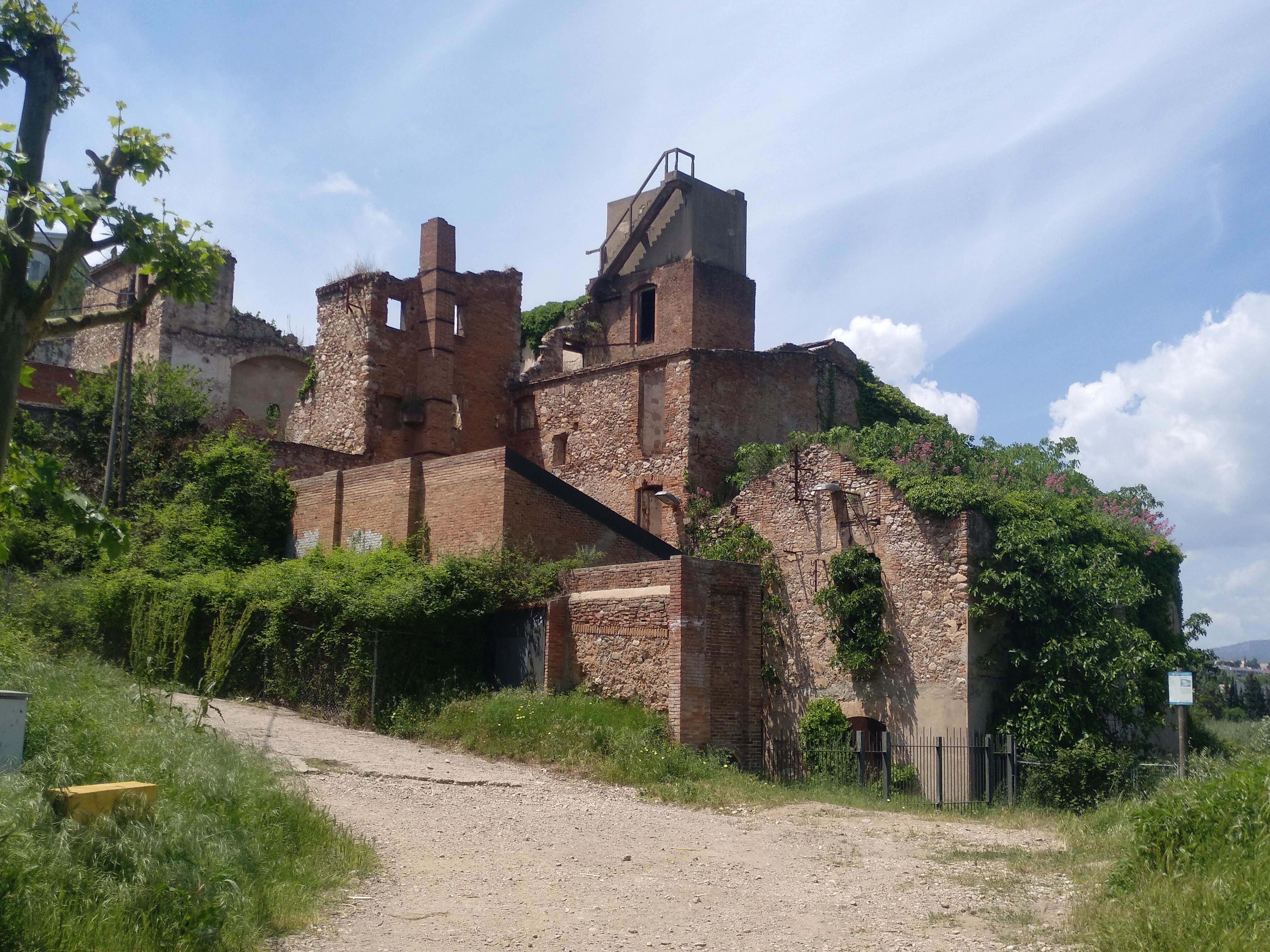
Continuing along the right bank, we will see the Molí d’en Mornau (Mornau’s Mill), an imposing building that is considered the largest paper mill of the eighteenth century in Catalonia. Over time it also functioned as a draper mill, a smoking paper factory and a wool and cotton cloth factory.
We will cross the river by the footbridge of Torrent Colobrers and continuing down, we will pass in front of the water treatment area of the water treatment plant and on the right bank of the river, we will find the rest area of Sant Vicenç de Jonqueres (where there are picnic tables and barbecues and you can stop to eat).
On the bridge you can continue the route along both banks: on the right bank there is the Parc de la Clota and the Font dels Gitanos (the Gypsies fountain). Continuing on the left bank, we will pass by the Font dels Degotalls (fountain of the droplets) to cross the river again through the ford of the Molí de Torrella (Torrella’s Mill). It is a mill of the medieval period currently in ruins, made up of different bodies staggered according to the differences in height of the ground.
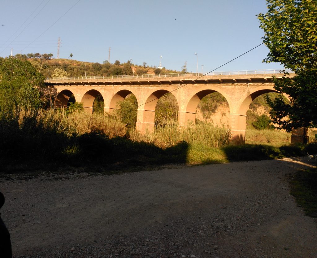
Passing under the La Salut bridge, we will find Ca la Daniela’s textile facotry, built in the late nineteenth century, dedicated to the washing, preparation and spinning of the prints, and we will also see the Horta Vella (formerly known as Horta Major), the oldest orchard in Sabadell.
We will have to continue until we reach the Torre-romeu footbridge, where we will cross the river again. We will continue along the river path and pass through the area of the Romau horta (Romau orchard), whose origins date back to the 14th century. The old name was horta del Pedregar (the road that led there from the city still bears the name: carrer del Pedregar).
We will have to continue south to the area of the municipal orchard of Can Roqueta, where the river is crossed by the bridge of Sant Oleguer. Once here, we will pass the Bassa de Sant Oleguer and you can head towards the Civic Center of Sant Oleguer, where you can find the bus stops for our return.
Further information:
http://ca.sabadell.cat/MediAmbient/d/parcfluvial.pdf
How to get there
Please note that this is a linear initnerary. It is possible to reach the point of departure and return by public transport. Check the timetables and itineraries of Sabadell’s bus lines here.
Departure:
River Park – Sant Julià d ‘Altura / Bosc de Can Deu (Bus line 1, 2, 3 and 7)
Arrival:
Parque Fluvial – Sant Oleguer (Bus line 5, LF15 – line that arrives at Bassa de Sant Oleguer)
Rating
[Total: 1 Average: 2/5]
Gallery

Share


Send


No Comments