We enter in the Parc de Collserola on a road between canes in direction to torre Cendrera. From the area around this small forest masia we head for to the hill of Torrefera by a leafy forest of white pine. Little by little our road turns slightly to the left to take us to Can Borrell, a masia from the 18th century in the middle of the valley of Gausach. We will continue to the Riera de Sant Medir and we will cross the course of the water several times until the valley widens and we arrive at the hermitage of Sant Medir, a meeting place for the pilgrims every 3rd March.
We return by the same path that has led us to the hermitage and once in Can Borrell we will continue bordering the ravine of Sant Medir until we reach the Pi d’en Xandri, one of the oldest pine trees of Collserola. Finally, a trail will connect to the way back to the riding centre.
ROUTE
We leave behind the riding centre, by the road that passes between the canes at the bottom and cross the stream. Parallel to this we take the path to the left, until the crossing that heads for to the side of the forest, to the right. We’re going deeper in the forest, where it dominates the white pine with a clean undergrowth for the most part. We find some point of north slope, where there are more oak pines and some dispersed oaks. The path goes up by a soft slope upwards. We find different detours, but we are making progress toward the indication of torre Cendrera, small farm forestry. Just past this, the path makes a slight turn to the right and goes down towards Can Borrell. We will arrive at a little wider track, of stuffing soil, with a dense pine forest with heather that we take to the right. If we went to the left, we would come to Can Coll, another possible route, of three hours.
A couple of curves later, we will see the house of Can Borrell. Before we arrive, we pass by a point where they are picked up the pine trees of the little forest exploitation that is carried out in the area. We pass a bridge with the stream and we head for to pass in front of the masia, currently being restored. We border it by turning to the left and we find a detour: we would go to the reservoir of Can Borrell. We continue by the plain path that passes through a dense forest over all of white pine, but with a rich undergrowth: steppes, mastic and heather. In some points it dominates the holm oak, with laurestine, Mediterranean buckthorn, honeysuckles and butcher’s-broom.
The road heads for little by little, we will see the detour toward Sant Adjutori (Romanesque chapel of circular plan, unique in the Parc de Collserola), we will pass three courses of water of low flow where we’ll find bramble, tender herbaceous, mint (which we will smell when we tread on it) and violets, among others. At this point we also feel the greatest soil moisture with the poplars, banana trees and willows that we find.
After the third stream the path already rises and the valley widens slightly, until we can see the roofs of buildings: the hermitage of Sant Medir. When we arrive we will see a source on the right and on the left, at the top of the bank, we will be able to water and tie the horses in order to be able to stretch our legs, drink a little and look at the hermitage.
When we have rested, we will have to redo the road until Can Borrell and when we get there, continue straight ahead, leaving the house and the way by which we had arrived before, on the right. Going down, we see that the forest is becoming drier, it dominates the white pine instead of the oak again and we see grain fields dispersed among the forest.
We continue this wide track, the GR-6, almost up to get to the Pi d’en Xandri, a large pine with the widest crown of the whole park. Just before arriving we will head for to the right, following the field margin, which we border to the left until we find the young pine forest. At the end of the field, we turn left, with the Sant Llorenç del Munt in front, with the field to the left and the forest to the right, until a path is diverted and we go through surrounded by holm oaks and pine trees to another field that there is a lot of time since it was cultivated, which we can see by the high bushes of redoul, gorse and broom. We are going through, following towards the industrial units of the cement factory, we have left diagonally to the right, we go down the road and turn left to the road that passes through the reeds and we return to the horse riding.
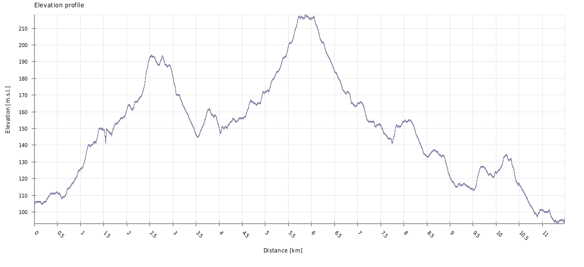
ACCUMULATE GRADE
DON’T MISS…

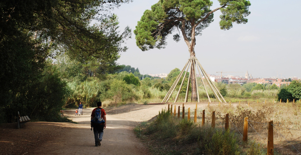
Parc de Collserola: it is a green surface of more than 8000 situated between the rivers Llobregat and Besòs, the depression of the Vallès and the plain of Barcelona. A green island in the middle of one of the more dense urban areas on the Mediterranean coast that includes part of the municipal area of nine cities.
The Collserola massif, of 17 km in length and 6 km in width, looks out to the sea from a very steep slope and in the Vallès from numerous valleys and wooded areas. Its profile is made up of numerous hills and the Tibidabo is the highest one (512 m.). The human footprint is manifested in the mountain range, both by the modification of the landscape and the amount of archaeological remains and constructions that are found and which constitute a very valuable heritage.
Can Borrell: masia from the 17th century that due to its location in the old way of Sant Cugat to Barcelona and transit point towards Sant Medir, became a forced stop, first by the farmers of the area that brought their products to the capital and later by hikers and pilgrims of Sant Medir. On the day of this celebration the house opened its doors to the front and back and became a part of the way. On the way back, there was a dance and danced the last sardana of l’Aplec. Until recently, it was still celebrated the last dance of the party.
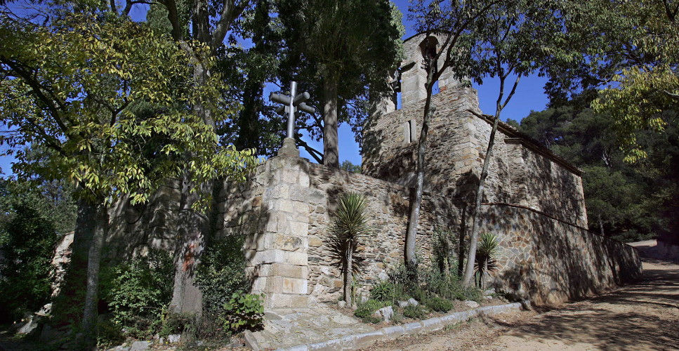
Sant Medir: chapel of Romanesque origin, formerly called Sant Emeteri. The first documented references date back to the year 962 as a property of the monastery of Sant Cugat. It was remodelled in 1447. The popularization of the legend of Saint Medir in a centre of pilgrimage, celebrating the year 1802 the first meeting of Sant Medir (3 March). Hermitage of square apse, covered by a barrel vault and with a belfry on the facade. Inside you can find original drafts of the mural paintings that the local artist Josep Grau-Chaparral projected on 1948 and that were not carried out.
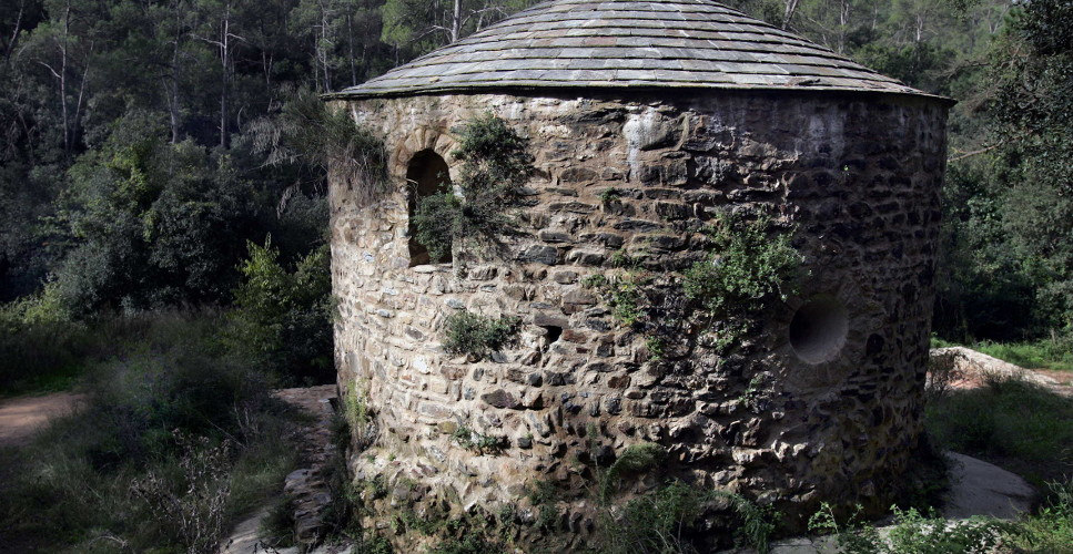
Sant Adjutori: Romanesque chapel of circular plan, without apse, which made the functions of parish until the 14th century. Located next to the old way of Barcelona, they are recorded celebrations and meetings until 1760. Formerly also called Santa Maria de Gausach or Mare de Déu del Bosc.
Can Gener spring: in the mountain range of Collserola water is abundant and there are a large number of springs in the park.
Pi d’en Xandri: pine tree of considerable height, located among the cultivated fields close to Sant Cugat. It is 23 meters height and has a trunk of 3.20 meters of perimeter. On 1995 it was declared tree of local and regional interest. On 1997 it suffered an attack of vandalism that caused it very serious damage. It was necessary to insert living wood in the wounds so that the sap could return to move and it was braced.
SUGGESTIONS
The torre Negra, the springs of Sant Vicenç and Gordi, the reservoir of Can Borrell and the masia Can Coll are points of interest near this route.
Place
Sant Cugat del Vallès
Where to start
Avinguda de les Corts Catalanes, 3
Duration
3 h
Distance
11,5 km
Technical Difficulty
Media
Contact
Company: Horse riding Sant Cugat
Telephone: 619462142
WEB SITE: www.hipicasantcugat.es
Mail: lauradurba@ya.com
Contact: Laura Durbà
Price: to be consulted
Attendees: They have 14 horses for excursions
Score
[Total: 0 Average: 0/5]
Gallery

Share it


Send it to a friend


Download GPX route
![]()
No Comments